St Just Coast - Kenidjack, Cape Cornwall and Cot Valley
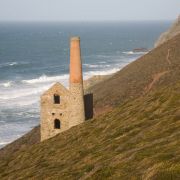
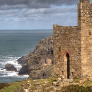
Not far along the cliffs from the Crowns Engine Houses, and past several more tall chimneys and cordoned-off mine shafts, lies what remains of the Kenidjack Cliff Castle, an Iron-Age promontory fort. All that can be seen of the fort today is a triple-ditched defence line, although the castle site offers stunning views across to Cape Cornwall and down into the Kenidjack Valley. This small wooded valley is a stone's throw from St Just and home to no less than eight former mines. This concentration of industry was probably due to a small river, rare on this stretch of coastline, which meets the sea at the rugged and rocky cove of Porthledden. When mining arrived this tiny river, already being used to turn mill wheels, was thoroughly milked and what is little more than a stream once powered upwards of fifty waterwheels. It's course was repeatedly altered to better serve the mines and countless manmade watercourses can still be seen today, winding along the sides of the valley. The atmosphere of Kenidjack Valley is still thoroughly dominated by the imposing granite gravestones of former industrial activity. Of particular note is the huge masonry pit at the lower end of the valley, right by the sea, built from enormous chunks of granite in order to accommodate a fifty-two foot water wheel for Kenidjack's largest mine. Wheal Call (Great Wheel) was the second largest mine in the whole of Britain at the time, with a sixty-five foot diameter, from which the last men were discharged in 1896.
It was impossible to see any of Kenidjack's mining remnants until recently due to a terrifyingly tenacious plant introduced to Britain in the 19th century called Japanese Knotweed. The plant can demolish concrete and tarmac, lie dormant for more than a decade and, most worrying of all, can reproduce from a fragment of leaf or stem less than the size of a drawing pin. Cutting it back normally, a practice which is now illegal, causes the plant to spread like wildfire, rampaging across the landscape. For the past three years, local landowners including the National Trust and Cornwall County Council have been working here and at other sites to control the plant by means of painstakingly cutting it down and disposing of the branches in specially designated toxic waste sites and then injecting the stems with strong weedkiller. Although very successful, this is only a short-term solution. The latest lomg-term idea is to introduce a species of Japanese jumping plant lice to act as a predator.
At low tide it is possible to clamber across the boulders that connect Porthledden with the eastern side of Cape Cornwall (otherwise take the clearly-marked path which goes up the side of the valley). This spectacular hump-backed headland is two hundred and twenty-nine feet high and has a two hundred and seventy degree aspect. Cape Cornwall is not, strictly speaking, a cape (the place where two seas meet) as the Atlantic actually meets the English Channel about ten miles further west, at Gwennap Head, and nor is it Land's End, another claim disproved by modern map making. It does, however, have a compelling atmosphere and is close to one of the most beautifully situated golf courses in the country.
Like most headlands on the St Just coast, Cape Cornwall does have it's own mining remnant, a ruined chimney stack nearly one hundred and fifty years old. It is also home to a National Coastwatch station, which looks out over the Brisons, a bristling offshore reef that has been the scene of many a wreck. The western side of the Cape shelters Priest's Cove, a working fishing cove with characterful fishermen's huts built into the granite at the back of a rocky beach, home to a semi man-made outdoor swimming pool which is accessible at low tide. The rock here at Cape Cornwall is geologically complex, marking the boundary between the dark metamorphosed sedimentary rock that characterises the north coast, and the lighter, smoothed granite found in west Penwith. Cape Cornwall was bought for the nation by H.J. Heinz and given to the National Trust in 1987. The Trust operates an information point and a car park overlooking the cove. There are toilets in the car park and a snack bar in summer run by the lovely Sheila - best carrot cake ever!
A steep rough track leads up from Cape Cornwall to Carn Gloose, a glorious section of high granite cliffs with excellent views right across to Sennen. A narrow lane, which heads back to St Just, leads past more ruined mine chimneys to the Bollowal Barrow, a huge and unique megalithic structure originally covered with a cairn of stones more than twenty metres in diameter. The barrow has been lovingly restored by the National Trust, who own Carn Gloose, in conjunction with English Heritage. Three stone cists, two with cremations inside, were discovered in the interior of the barrow, which is an excellent example of a Bronze Age chambered tomb. The barrow is easily accessible to passers-by, with information posts nearby. Due to it's high situation and excellent views, Carn Gloose has been the base for a number of scientific sea watching exercises. The most recent of these was in July 2009 when a whale and dolphin watch took place there as part of National Whale and Dolphin Week.
Continue along the coast path towards Land's End and you will pass fenced-off mine shafts and collapsed chimneys before plunging down into the lush sub-tropical splendour of Cot Valley.
A handful of houses nestle in the upper reaches of this wooded valley, which lies about a mile south of St Just (if driving, follow signs from the town). The valley is bisected by a narrow lane and a stream and the houses soon give way to uncultivated land. Like Kenidjack, by the time the stream reaches the sea, the valley feels deliciously remote, with parking for about ten cars but no facilities. There is a unique raised beach here, which has SSSI status and can be clearly seen at low tide, while Porth Nanven Cove, over the saddle to the south of the valley, is a popular spot for swimming and snorkelling. Cot Valley, which has seen many rarities, including an American Yellow-Billed Cuckoo, is popular with birdwatchers and fishermen alike.
An exhilarating zig-zag up the side of the valley will bring you once more to the top of high cliffs. The path does not drop down to sea level again until Nanquidno, a gorgeously wild cove two miles north of Sennen. A small wooden bridge crosses a stream that was formerly used for turning mill wheels, evidence of which can be found further up the valley. The valley is wooded in the upper reaches and very popular with birdwatchers, especially in autumn. There is parking for about six cars (turn right just before the airfield if travelling from St Just to Sennen) but other than that there are no facilities. It is sometimes possible to swim at the cove on a calm day in summer, although there is no sand and it is necessary to launch off rocks. There is an elusive reef here, popular with local surfers.
Morvah, Pendeen, Levant and Botallack »


